3.4.4.8. Vector to raster
Vector to raster
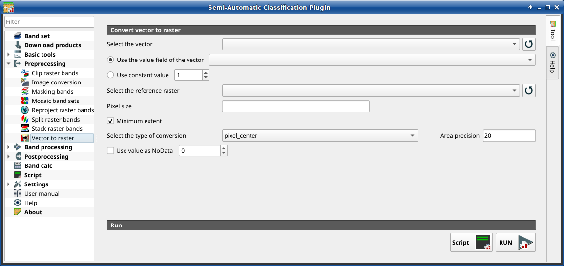
This tab allows for the conversion of a vector (polygon) to raster format.
Порада
Information about APIs of this tool in Remotior Sensus at this link .
3.4.4.8.1. Convert vector to raster
Tool symbol and name |
Description |
|---|---|
Select the vector |
select a vector already loaded in QGIS |
|
refresh layer list |
|
if checked, the selected field is used as attribute for the conversion; pixels of the output raster have the same values as the vector attribute |
|
if checked, the polygons are converted to raster using the selected constant value |
Select the reference raster |
select a reference raster; pixels of the output raster have the same size and alignment as the reference raster |
|
refresh layer list |
Pixel size |
set the size of pixel of output raster |
|
if checked, the output raster has the minimum vector extent;
otherwise, output extent is the same as the
Select the reference raster |
Select the type of conversion |
|
Area precision |
for area_based method, the higher the value, the higher is the precision in the calculation of area proportion (and the time required for calculation) |
|
if checked, set a value for |
Script |
add this function to the Script |
RUN |
run this function |


