3.4.4.5. Reproject raster bands
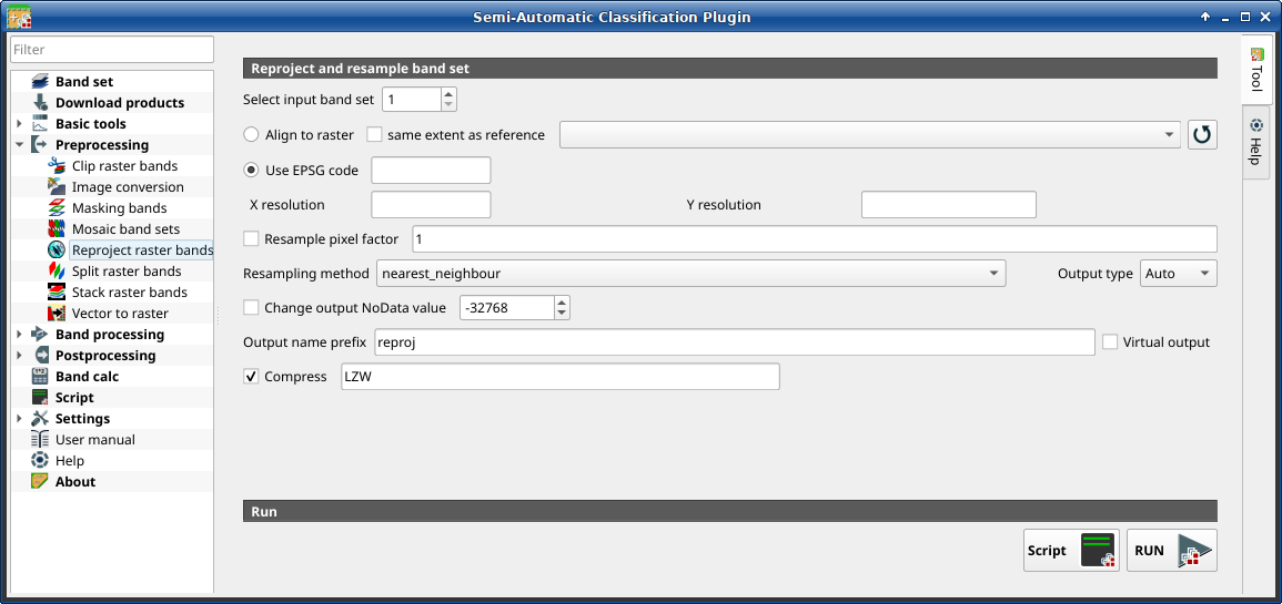
Reproject raster bands
This tab allows for reprojecting bands in a Band set and perform other raster operations.
Порада
Information about APIs of this tool in Remotior Sensus at this link .
3.4.4.5.1. Reproject raster bands
Tool symbol and name |
Description |
|---|---|
Select input band set |
select the input Band set to be reprojected |
|
if checked, use the same coordinate reference system and pixel size as the selected reference |
|
if checked, the output extent will be the same as the reference |
|
refresh layer list |
|
if checked, use the EPSG code for defining the output coordinate reference system |
X resolution |
set X pixel resolution |
Y resolution |
set Y pixel resolution |
|
if checked, new pixel size will be the original size times this factor |
Resampling method |
select the resampling method; options are: |
Output type |
select the output raster type; options are: |
|
if checked, set a new value for |
Output name prefix |
set the prefix for output file names (default is |
Compress |
if checked, set the compression method (e.g., LZW, DEFLATE) |
Script |
add this function to the Script |
RUN |
run this function |


