3.4.3.3. Multiple ROI Creation
 Multiple ROI Creation
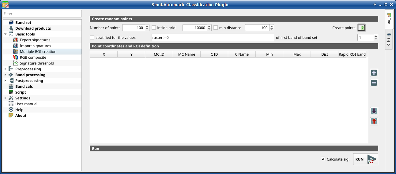
This tab allows for the automatic creation of ROIs, useful for the rapid classification of multi-temporal images, or for accuracy assessment. Given a list of point coordinates and ROI options, this tool performs the region growing of ROIs. Created ROIs are automatically saved to the Training input. The active band set in Band set is used for calculations.
3.4.3.3.1. Create random points
Tool symbol and name |
Description |
|---|---|
Number of points |
set a number of points that will be created when
Create points |
|
if checked, the band set area is divided in cells where the
size thereof is defined in the combobox (image unit, usually meters);
points defined in |
|
if checked, random points have a minimum distance defined in the combobox (image unit, usually meters); setting a minimum distance can result in fewer points than the number defined in Number of points |
Create points |
create random points inside the band set area |
|
if checked, create random points inside the values defined in the
expression calculated for the first band of the defined band set; the
expression must include the variable |
of the first band of band set |
defines the band set in
|


3.4.3.3.2. Point coordinates and ROI definition
The table Point coordinates and ROI definition contains the following fields.
X |
Y |
MC ID |
MC Name |
C ID |
C Name |
Min |
Max |
Dist |
Rapid ROI band |
|---|---|---|---|---|---|---|---|---|---|
point X coordinate (float) |
point Y coordinate (float) |
ROI Macroclass ID (int) |
ROI Macroclass Name (text) |
ROI Class ID (int) |
ROI Class Name (text) |
the minimum area of a ROI (in pixel unit) |
the maximum width of a ROI (in pixel unit) |
the interval which defines the maximum spectral distance between the seed pixel and the surrounding pixels (in radiometry unit) |
if a band number is defined, ROI is created only using the selected band, similarly to Rapid ROI band in ROI & Signature list |
The following tools are available.
Tool symbol and name |
Description |
|---|---|
|
add a new row to the table; all the table fields must be filled for the ROI creation |
|
delete the highlighted rows from the table |
|
import a point list from text file or a point shapefile to the table;
in case of text file, every line must contain values separated by
tabs of |
|
export the point list to text file |
|
if checked, the spectral signature is calculated while the ROI is saved to Training input |
RUN |
start the ROI creation process for all the points and save ROIs to the Training input |


